

Applications
Mineral Identification
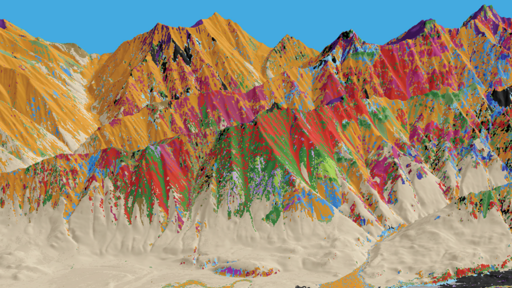
Hyperspectral imaging enables mineral identification by capturing continuous, high-resolution spectra across hundreds of narrow wavelength bands, allowing detection of diagnostic absorption features related to specific mineral compositions. By comparing these spectral signatures with reference libraries, it can accurately map and distinguish minerals, such as clays, carbonates, and iron oxides, even in complex or mixed geological settings.
Mineral Mapping
Critical Minerals
Rare Earth Elements
Mineral Mapping
Hyperspectral imaging enables mineral identification by capturing continuous, high-resolution spectra across hundreds of narrow wavelength bands, allowing detection of diagnostic absorption features related to specific mineral compositions. By comparing these spectral signatures with reference libraries, it can accurately map and distinguish minerals, such as clays, carbonates, and iron oxides, even in complex or mixed geological settings.
Ocean Colors
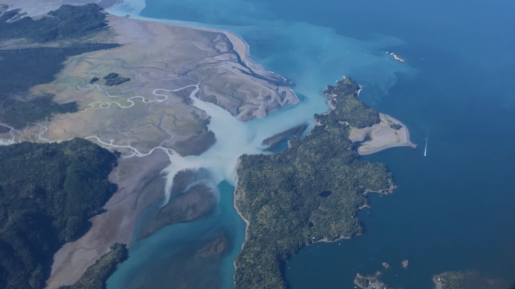
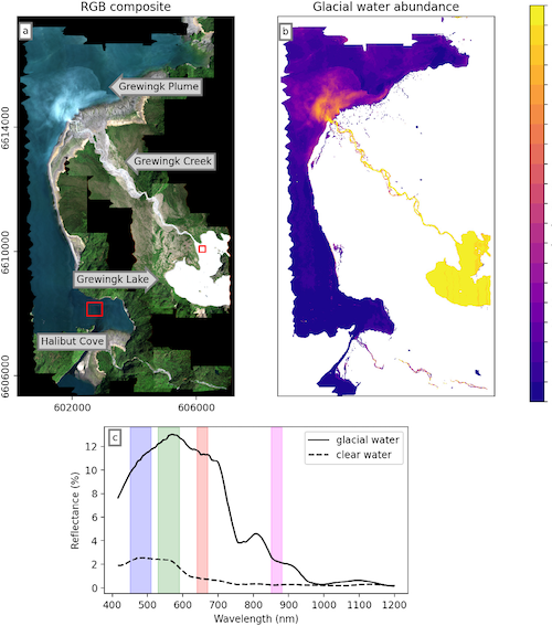
Hyperspectral imaging enables turbidity mapping as a proxy for glacial sediment influx by analyzing water reflectance in the 416–1200 nm range, where signals remain usable. Its high spectral resolution improves detection of suspended sediments over conventional indices, as demonstrated in Kachemak Bay, Alaska, where it better captures surface sediment distribution.
Turbidity Mapping
Glacial Sediment
Hyperspectral imaging enables turbidity mapping as a proxy for glacial sediment influx by analyzing water reflectance within the 416–1200 nm range, where useful signals remain due to strong SWIR absorption by water. By leveraging its high spectral resolution, hyperspectral data can better distinguish subtle variations in suspended sediments compared to conventional multispectral indices such as NDWI and NDTI. Case studies, such as surveys in Kachemak Bay, Alaska, demonstrate that hyperspectral-derived turbidity maps more accurately capture the spatial distribution of glacial sediments at the water surface, making them particularly valuable for monitoring habitat conditions in glacially influenced aquatic ecosystems.
Glacier & Snow/Ice Analysis
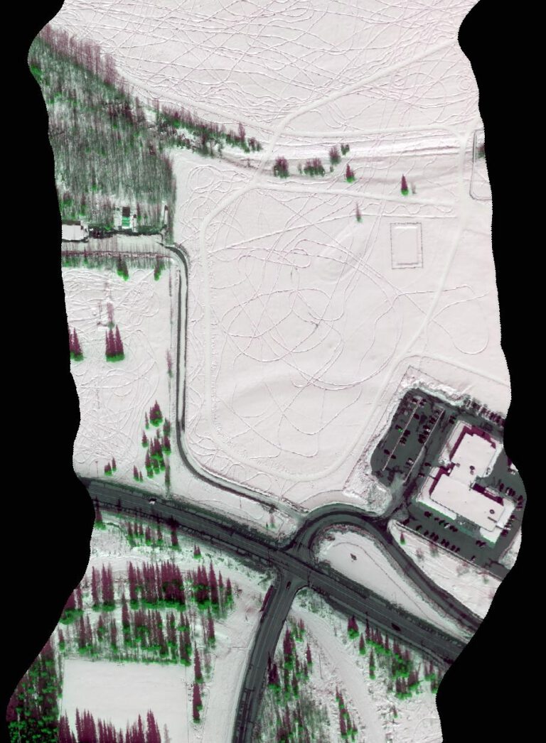
One focus of HyLab’s research is the monitoring and analysis of glaciers, seasonal snow, and sea ice, supported by extensive hyperspectral data collection campaigns across major glaciers, the Arctic, and Alaska’s interior. These efforts underpin studies of glacier and snow albedo variability and the effects of light-absorbing particles on snowpack evolution using hyperspectral data.
Albedo
Light Absorbing Particles
Glacier Retreat
One component of HyLab’s research portfolio involves the monitoring and analysis of glaciers, seasonal snow, and sea ice. To advance this work, HyLab has carried out extensive data collection campaigns across major glaciers, the Arctic, and Alaska’s interior. Building on these efforts, HyLab researchers investigate glacier and snow albedo variability, as well as the influence of light-absorbing particles on snowpack evolution, using hyperspectral instrumentation. Planned research activities will further emphasize change detection and the comprehensive characterization of snow and ice employing advanced machine learning methodologies.
Wildfire Monitoring
Alaska has experienced a substantial and increasing number of wildfires in recent years, with larger areas affected due to changing summer weather situations. In 2004, a record 6.5 million acres burned, followed by 5.1 million acres in 2015, the second-highest total on record [12]. In 2025, the Alaska fire season has already consumed over 1 million acres according to the Alaska Interagency Coordination Center (AICC) dashboard [13, 14]. These figures underscore the urgent need for enhanced wildfire management strategies.
Wildfire Fuel Classification
Alaska has experienced a substantial and increasing number of wildfires in recent years, with larger areas affected due to changing summer weather situations. In 2004, a record 6.5 million acres burned, followed by 5.1 million acres in 2015, the second-highest total on record [12]. In 2025, the Alaska fire season has already consumed over 1 million acres according to the Alaska Interagency Coordination Center (AICC) dashboard [13, 14]. These figures underscore the urgent need for enhanced wildfire management strategies.
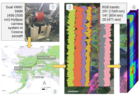
A critical component of these strategies is the accurate mapping of wildfire fuels and assessment of fire severity within boreal ecosystems. Wildfire fuel mapping involves identifying and classifying vegetation types that contribute to fire propagation. Hyperspectral imaging can differentiate between vegetation types and provide high-resolution fuel maps essential for predictive modeling and mitigation efforts [15]. HyLab conducted hyperspectral surveys at two representative boreal forest sites in interior Alaska: the Caribou-Poker Creeks Research Watershed (CPCRW) and the Bonanza Creek Experimental Forest (BCEF). Each site was imaged twice—CPCRW in 2019 and 2021, and BCEF in 2020 and 2021. These sites encompass a typical mix of boreal forest vegetation, including fire-prone coniferous, mixed, and deciduous stands. Concurrent with airborne data collection, ground-truth vegetation information was obtained from over 100 survey locations across the two sites.
Harmful Algal Bloom (HABs)
Hyperspectral imaging is widely used for detecting harmful algal blooms (HABs) by capturing detailed spectral signatures of pigments such as chlorophyll-a and phycocyanin, which are indicative of algal presence and composition. Its high spectral resolution allows discrimination between different algal species and improves early detection and monitoring of bloom dynamics in coastal and inland waters.
Cyanobacteria
Alexandrium catenella
Chlorophyll-a
Hyperspectral imaging is widely used for detecting harmful algal blooms (HABs) by capturing detailed spectral signatures of pigments such as chlorophyll-a and phycocyanin, which are indicative of algal presence and composition. Its high spectral resolution allows discrimination between different algal species and improves early detection and monitoring of bloom dynamics in coastal and inland waters.
Geologic Hydrogen Exploration
Geologic hydrogen—sometimes called natural, white, or gold hydrogen—is an exciting new source of clean and potentially renewable energy. Unlike fossil fuels that take millions of years to form, natural hydrogen is continuously produced underground through reactions between water and iron-rich minerals. Airborne hyperspectral imaging offers a cutting-edge way to explore these hidden energy sources by spotting iron-rich rocks and analyzing vegetation patterns, such as fairy circles, that may hint at subsurface activity.